Key facts
- You climb it with a ticket for Route 1-A of the Panoramic circuit: 3.8 km round trip and high effort.
- The summit is at about 3,082 m, roughly 650 m above the citadel, almost all of it on stone stairways.
- Maximum time of 7 hours; we estimate about 3 to 4 h 30 min for the complete visit.
- There’s no grace period at the mountain checkpoint: get there with time to spare for the time on your ticket.
- The route doesn’t cover the urban sector: for the temples you need another ticket, for example for Circuit 2.
- Enter in one of the first time slots and spend the night before in Aguas Calientes.
In this guide
Machu Picchu Mountain is the summit that rises behind the citadel, on the opposite side from Huayna Picchu, at about 3,082 m. You climb it with a ticket for Route 1-A of the Panoramic circuit: about 3.8 km round trip, almost all of it on stone stairways, with high effort and a maximum of 7 hours inside. In return, from the top you get the widest view of the sanctuary and, on clear days, the snowcapped Salkantay and Pumasillo peaks.
Route 1-A at a Glance
| Detail | Route 1-A: Machu Picchu Mountain |
|---|---|
| Circuit | 1 – Panoramic |
| Round-trip distance | About 3.8 km |
| Summit elevation | About 3,082 m |
| Approximate elevation gain from the citadel (2,430 m) | About 650 m |
| Official effort level | High |
| Maximum time allowed | 7 hours |
| Grace period at the mountain checkpoint | None |
| Season | Year-round |
| What’s included | The terraces in the upper section, the summit and its viewpoints |
| What’s not included | The urban sector: main plaza, temples and Sacred Rock |
Distance, effort and description according to the official Tu Boleto platform; time allowed according to the official map of Route 1-A; summit elevation according to Inca Rail. The elevation gain is an approximate calculation.
The Route, Step by Step
The route is one-way, like every route at Machu Picchu since June 2024. Here’s how it goes, according to the official map:
- Main entrance. You go through the checkpoint with your ticket and your ID. Use the restroom first: it’s next to the entrance, outside the route.
- Terraces of the agricultural sector. The path zigzags up the terraces in the upper section, above the urban sector. You already get great views of the citadel from here.
- Mountain checkpoint. It’s at the top of the terraces. They check your ticket and the time: there’s no grace period at this checkpoint.
- Trail to the summit. Stone stairways that climb the mountainside, with a few forested stretches. There are few flat spots to rest.
- The summit. A small clearing with viewpoints over the Vilcanota Canyon, the citadel and the mountain range.
- Descent. Down the same trail to the terraces and, from there, toward the exit. You don’t go back into the urban sector.
Important: the Route 1-A ticket doesn’t include the main plaza or the temples. If it’s your first visit and you want to see the inside of the Inca city, you need a second ticket, for example for Circuit 2, in another time slot or on the following day. The differences between circuits are covered in Machu Picchu circuits: all 10 routes explained.
Difficulty: How Demanding Is It?
The Ministry of Culture rates it high effort, just like Huayna Picchu, but the kind of effort is different. Machu Picchu Mountain has no spots where you need to scramble with your hands: the difficulty lies in climbing about 650 m in a row on steps of uneven height, in humid conditions and often in full sun.
- Legs and lungs: it’s the longest route in the sanctuary. If you get tired walking uphill in Cusco, you’ll feel it here.
- Altitude: the summit is at about 3,082 m, lower than Cusco. If you’ve already spent two or three days in the region, the altitude usually isn’t the problem.
- Fear of heights: the stairways are wider than on Huayna Picchu. Near the summit the trail narrows and there’s a drop on one side, but no vertical sections.
- Knees: the descent is long, with tall steps. It’s where people with knee problems feel it most.
If you’re torn between this mountain and the one from the classic photo, you’ll find the full comparison of distance, vertigo, views and tickets in Huayna Picchu vs. Machu Picchu Mountain: which to choose.
How Long It Takes
The official map sets a maximum of 7 hours inside the sanctuary with this ticket. Most travelers don’t use all of it. This is our estimate based on years of experience in Cusco at a normal pace, with photo stops:
| Stage | Relaxed pace | Brisk pace |
|---|---|---|
| Main entrance to the mountain checkpoint | 20 min | 15 min |
| Climb to the summit | 2 h | 1 h 30 min |
| Time at the summit | 30 min | 20 min |
| Descent to the exit | 1 h 30 min | 1 h |
| Total | 4 h 20 min | 3 h 5 min |
Add the line and the bus ride back down to Aguas Calientes, 25 to 30 minutes. Based on this estimate, your return train should leave at least six hours after your entry time. You’ll find schedules in our guide to the train to Machu Picchu and uphill and downhill frequencies in our guide to the bus to Machu Picchu.
Best Time of Day and Time of Year to Climb
Time of Day
Choose one of the first morning time slots. You’ll climb in cooler temperatures, the trail is quieter and you’ll have time to wait for the mist to clear at the summit. To make an early entry without an extremely early start, spend the night before in Aguas Calientes; the first bus goes up at 5:30 a.m.
Keep in mind that there’s a 30-minute grace period at the main entrance, or 45 minutes in the highest-demand months (June 1 to October 15, plus December 30 and 31). There’s none at the mountain checkpoint: if your ticket shows a time for the mountain, get to that checkpoint with time to spare.
Time of Year
- Dry season (May to October): more clear days and better chances of seeing the snowcapped peaks. Also more people and fewer spots.
- Rainy season (November to April): more availability, but more mist, wet steps and rain that can last for hours. The descent calls for more care.
To pick your month, check our guide to Cusco weather by month.
Tip: if all you see at the summit is clouds, don’t head down right away. In the dry season the morning mist usually clears fairly quickly, and you have plenty of time within the 7-hour limit.
What You See from the Summit
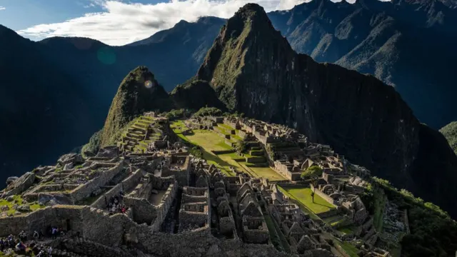
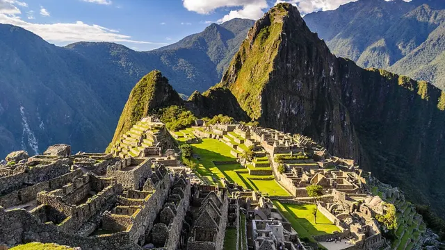
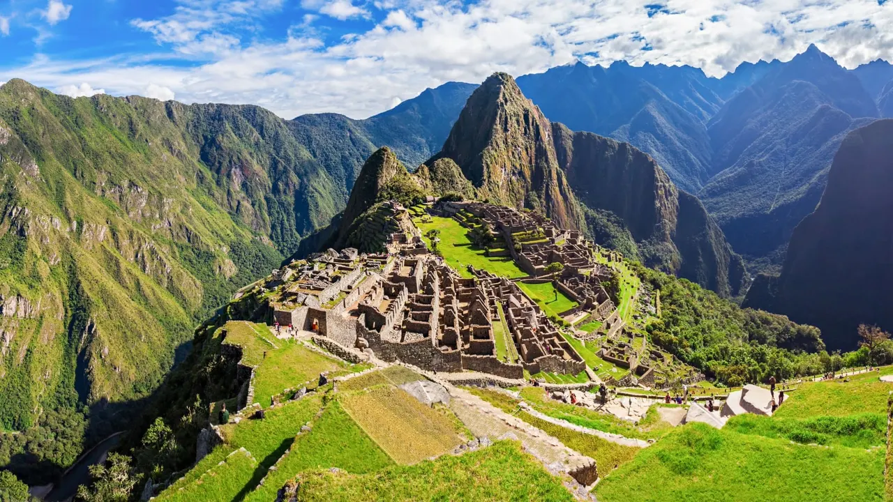
- The entire citadel, small and with Huayna Picchu behind it: the classic photo seen from much higher up.
- The Vilcanota River canyon, which wraps around the sanctuary, and the switchback road that climbs up from Aguas Calientes.
- The snowcapped Salkantay and Pumasillo peaks, which the Ministry of Culture highlights in its official route description, visible on clear days.
- The cloud forest landscape that surrounds Machu Picchu, with forest-covered mountains as far as the eye can see.
How to Get Your Ticket
The mountain isn’t bought separately: you choose Route 1-A of Circuit 1 when you buy your entry ticket, with a date and time. It has a much smaller daily quota than the circuits without a mountain and costs more; the official platform shows the exact price for your visitor category when you choose the route. For everything else about buying, in-person sales and fake websites, see our guide to Machu Picchu tickets.
- How far in advance: in peak season, buy as soon as you have your dates. It usually lasts longer than Huayna Picchu, but the morning time slots go first.
- In-person sales: the ticket office in Machu Picchu Pueblo also hands out a few Route 1-A spots for the following day. There are very few, and they usually run out the day before: don’t count on them.
- ID: the ticket is issued in your name. Bring it along with the passport or document you used to buy it; you may be asked for it at the entrance and at the mountain checkpoint.
What to Bring and What Not To
- Plenty of water. Nothing is sold inside the sanctuary and the climb is long. Bring at least a liter per person.
- Shoes with good grip. The rules ban high heels and hard-soled shoes.
- A rain poncho and a light warm layer. It’s windier at the summit than in the citadel.
- Sunscreen, a hat and insect repellent. Much of the trail is in full sun.
- A small backpack, no larger than 40 × 35 × 20 cm.
- No trekking poles, umbrellas, tripods or drones. They’re banned throughout the sanctuary.
- No food. The rules don’t allow food inside; eat a good breakfast before you go up.
The full list of banned items is in what not to bring to Machu Picchu.
Who It’s For and Who It’s Not For
- Yes, if you want the widest view of the sanctuary, enjoy hiking and have spent at least two days acclimatizing in the region.
- Yes, if Huayna Picchu is already sold out for your date or its trail scares you.
- Yes, if you’re visiting the citadel on another ticket and want a different second day.
- Better not, if you arrived in Cusco the day before, have knee problems or are traveling with young children. For families, check the options in Machu Picchu with kids.
- Better not, if you only have one ticket and it’s your first visit: you’d see very little of the inside of the Inca city.
If you’re looking for a summit with much less effort, the alternative is Huchuy Picchu, with moderate effort, although it only opens in peak season.
Bottom Line: Your Next Step
Machu Picchu Mountain is for anyone who wants to hike and see the whole sanctuary from above. Buy Route 1-A as soon as you have your dates, enter in one of the first time slots, spend the night before in Aguas Calientes and, if it’s your first visit, add another ticket for the urban sector.
A two-day trip with a night in town gives you time to climb without watching the clock. If you’d rather not add nights, a day trip from Cusco covers the guided visit to the citadel; with a mountain, that day gets very tight.
Frequently asked questions
Is Machu Picchu Mountain hard to climb?
It’s demanding in terms of endurance: about 650 m of elevation gain on stone steps. There’s no scrambling, but the climb is long and the descent is tough on your knees.
How long does it take to climb Machu Picchu Mountain?
We estimate between 1 h 30 min and 2 h to climb from the checkpoint, depending on your pace. The complete visit, including the descent, usually takes about 3 to 4 h 30 min.
How high is Machu Picchu Mountain?
Its summit is at about 3,082 m above sea level, higher than Huayna Picchu and lower than the city of Cusco.
Does the Machu Picchu Mountain route include the citadel?
Only the upper terraces. It doesn’t pass through the main plaza, the temples or the Sacred Rock; for those you need another ticket.
Is Machu Picchu Mountain scary if you’re afraid of heights?
Less so than Huayna Picchu. The stairways are wide, and only near the summit does the trail narrow, with a drop on one side.
Can I use trekking poles?
No. The sanctuary’s code of conduct bans trekking poles, so wear shoes with good grip.
Can you see the snowcapped peaks from the summit?
On clear days you can see Salkantay and Pumasillo. Your chances are better in the dry season and at mid-morning, when the mist clears.
Official sources
- Tu Boleto (Ministry of Culture): official description of Route 1-A
- Official map of Route 1-A (Machupicchu Mountain)
- Ministry of Culture: circuits and visiting routes
- Ministry of Culture: entry times and grace periods
- Ministry of Culture: Machu Picchu code of conduct
- Tu Boleto: availability and in-person sales by route
- Inca Rail: comparison of the Machu Picchu mountains (elevations)