Key facts
- Arequipa is 515 km from Cusco: about 10 hours by bus or around 1 hour by plane, according to PromPerú.
- Arequipa’s Historic Centre, built of sillar stone, has been a UNESCO World Heritage Site since 2000; the city sits at 2,335 m.
- Chivay, the gateway to Colca, is 151 km from Arequipa, about 3 hours on a paved road.
- Colca Canyon is 3,200 m deep according to PromPerú and 4,160 m according to AUTOCOLCA, measured at Canco (Huambo).
- At Cruz del Cóndor, your best chance of seeing condors is between 7:00 and 10:00 a.m., so it pays to sleep in the valley.
- The road to Colca crosses Patapampa, at 4,910 m: do it after acclimatizing in Cusco or after two or three nights in Arequipa.
In this guide
- Where is Arequipa, and how long does it take from Cusco?
- Arequipa at a glance: what to see in the White City
- What is Colca Canyon, and how deep is it?
- How to get from Cusco to Arequipa: bus or plane
- How to get from Arequipa to Colca Canyon
- The southern loop: Cusco, Puno and Arequipa
- How many days do you need? Itineraries for Arequipa and Colca
- Altitude: Colca is much higher than Arequipa
- Best time to visit Arequipa and Colca
- Summary: how to add Arequipa and Colca to your Cusco trip
Arequipa lies south of Cusco, 515 km away by road: about 10 hours by bus or around 1 hour by plane, according to PromPerú. Colca Canyon is 151 km from Arequipa, about 3 hours by road to Chivay, so most travelers combine the two in 3 or 4 days: one or two in the city and two in Colca, with a night in the valley. If you have a week or more, do the southern loop: Cusco, Puno and Lake Titicaca, Arequipa and Colca.
From Cusco, we’re often asked whether it’s worth adding southern Peru to the trip. For many travelers, yes: Arequipa is a colonial city that sits lower and is milder than Cusco, and Colca offers condors, colonial villages and volcanoes. Here we explain how to fit it around your time in Cusco, how many days to set aside and how to handle the altitude, which in Colca is much higher than in Arequipa.
Where is Arequipa, and how long does it take from Cusco?
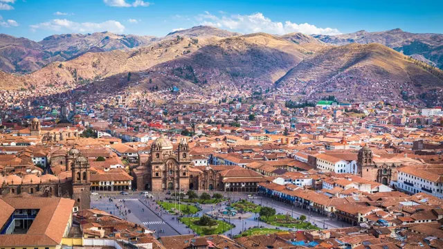
Arequipa is the capital of the region of the same name, on the coast and in the highlands of southern Peru. The city sits at 2,335 m, according to PromPerú’s practical guide, more than 1,000 m below Cusco. UNESCO places it at the foot of three snow-capped volcanoes, which PromPerú identifies as Misti, Chachani and Pichu Pichu.
These are the distances and travel times PromPerú publishes for getting between Arequipa and other cities in the south:
- Cusco–Arequipa: 515 km by road, about 10 hours; by plane, around 1 hour.
- Puno–Arequipa: 325 km, about 6 hours by road.
- Arequipa–Chivay (Colca): 151 km, about 3 hours by car and about 3 h 30 min by bus.
- Lima–Arequipa: 1,009 km, about 16 hours by road; by plane, around 1 h 15 min.
Arequipa isn’t a day trip from Cusco: if you’re including Colca, set aside three or four days.
Arequipa at a glance: what to see in the White City
The Historic Centre, a World Heritage Site since 2000
UNESCO inscribed the Historic Centre of Arequipa on the World Heritage List in 2000. What makes it unique is sillar, a white or pinkish volcanic stone used for almost all of its buildings. According to UNESCO, its architecture blends European and Indigenous techniques, with thick walls, vaults and richly decorated Baroque facades designed to withstand earthquakes. The city was founded in 1540.
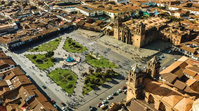
For a first walk, PromPerú highlights the Plaza de Armas and its cathedral, the Compañía de Jesús complex, San Francisco, San Agustín and the colonial mansions with their wide courtyards. The Yanahuara viewpoint, 2 km from the center, offers one of the best views of Misti.
Santa Catalina Monastery
This is the must-see. UNESCO calls it a “religious citadel” with architectural styles from the 16th to the 19th centuries. According to PromPerú, it was a fully cloistered convent from its opening in 1579 until 1970. Today you explore it through streets, courtyards, cloisters and cells, like a small town inside the city. Allow at least two hours.
Juanita and the volcanoes
The Museo Santuarios Andinos, run by the Universidad Católica de Santa María, displays Juanita from May to December: an Inca girl offered on Mount Ampato more than 500 years ago. Misti, the volcano that towers over the city, reaches 5,825 m according to PromPerú and lies within the Salinas y Aguada Blanca National Reserve.
Arequipa is also a place to eat well. PromPerú highlights its picanterías, the chupes (hearty soups), rocoto relleno (stuffed hot peppers), Sunday adobo and queso helado, a local ice-cream dessert. If you’ve already tried rocoto relleno in Cusco, read our guide to traditional Cusco food: we explain there that it’s a dish born in Arequipa.
What is Colca Canyon, and how deep is it?
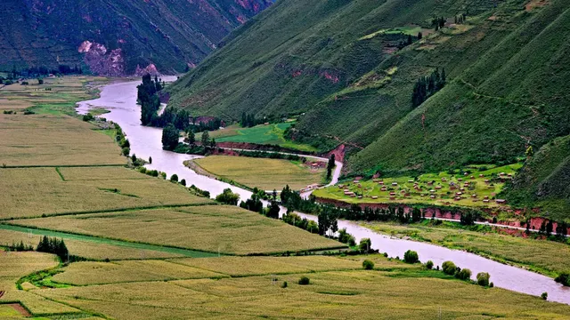
Colca is a valley and canyon carved by the Colca River in the province of Caylloma, northwest of the city of Arequipa. Its villages have pre-Hispanic terraces and colonial churches more than 400 years old, and the Wititi dance, native to the valley, has been on UNESCO’s list of Intangible Cultural Heritage of Humanity since 2015. In 2019, UNESCO also declared the Colca and Andagua Volcanoes UNESCO Global Geopark, the first in Peru.
You’ll come across different figures for its depth, and it’s not your mistake:
- 3,200 m: the figure given in PromPerú’s practical guide and on the Colca page of Peru Travel.
- 4,160 m: the maximum depth cited by the Colca Autonomous Authority (AUTOCOLCA), measured in the Canco sector, Huambo district, according to the Andina news agency. PromPerú’s guide “Rutas cortas desde Arequipa” (Short Routes from Arequipa) repeats this figure.
The figures vary depending on where it’s measured; either way, it’s one of the deepest canyons on the planet.
Chivay and the hot springs
Chivay is the provincial capital and the gateway to the valley, at about 3,651 m according to PromPerú. Three kilometers away, about 8 minutes by bus, are the La Calera hot springs; in Yanque, 8 km from Chivay, are the Chacapi springs. PromPerú notes that the valley’s thermal waters leave the spring at up to 85 °C; Chacapi has two open-air pools of warm water. The hot springs charge their own entry fee.
In Yanque, children also dance the Wititi in the main square in the mornings, according to PromPerú.
The Cruz del Cóndor viewpoint
It’s 42 km west of Chivay, around 1 h 30 min by bus, at about 3,660 m. From here to Cabanaconde, you can take in the full depth of the canyon and, with luck, the gliding flight of the Andean condor, which rides the warm air currents rising from the canyon. According to PromPerú, your best chance of seeing it is between 7:00 and 10:00 a.m. It’s a wild bird, so there are no guarantees.
Tip: sleep in Chivay or another village in the valley and head to Cruz del Cóndor first thing in the morning. If you do Colca in a single day from Arequipa, you’ll only make that window by leaving before dawn, and you’ll spend about 10 hours on the road round trip.
Patapampa, the Mirador de los Volcanes and the Salinas y Aguada Blanca Reserve
The road from Arequipa to Chivay crosses the Salinas y Aguada Blanca National Reserve, a protected natural area created on August 9, 1979, covering almost 367,000 hectares with an average altitude of 4,300 m, according to Andina; it’s managed by SERNANP, Peru’s protected areas service. Its most representative species is the vicuña, according to PromPerú. To learn how to tell it apart from alpacas and llamas, read llamas and alpacas in Cusco.
At the highest point of the drive is Patapampa, at 4,910 m according to PromPerú. This is where the Mirador de los Volcanes (Volcanoes Viewpoint) is, looking out over the snow-capped peaks and volcanoes of the area.
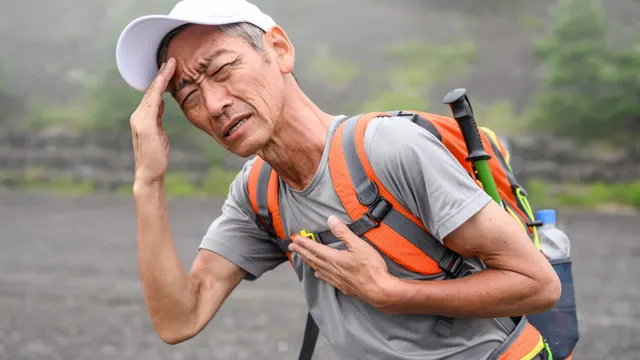
Important: Patapampa is more than 1,500 m higher than Cusco. Even though the stop only lasts a few minutes, you’ll feel it: walk slowly, don’t rush for photos and avoid alcohol the night before. If you get a severe headache, nausea or dizziness that gets worse, tell someone and head down toward Chivay.
How to get from Cusco to Arequipa: bus or plane
By plane
It’s the fastest option: around 1 hour in the air, according to PromPerú. Check whether there’s a direct flight on your dates; if not, the alternative is to connect through Lima. We explain this in how to get from Lima to Cusco, where we also cover combining flights to Arequipa or Juliaca with overland travel.
By bus
It’s 515 km and about 10 hours by road. It’s the cheapest option, but it’s a long ride through high parts of the Andes. Always buy from licensed companies at the bus terminal, and bring warm clothes: the puna gets cold at night. To work out what this leg adds to your trip, use our Cusco trip budget guide.
How to get from Arequipa to Colca Canyon
The route leaves Arequipa on the road toward Yura and Puno. At the Patahuasi toll booth, 1 h 50 min from the city, you take the turnoff to Chivay, according to PromPerú. The road is paved and signposted all the way to Chivay. There are three ways to do it:
- Organized tour: the most common option. It usually includes transportation, stops in the reserve and at Patapampa, and Cruz del Cóndor. Choose licensed operators, as PromPerú recommends.
- Public bus: there’s a daily service from Arequipa’s bus terminal to the villages on the left bank of the river, according to PromPerú. From Chivay, local vehicles run to the right bank and the upper valley.
- Your own car or a car with driver: it gives you the freedom to stop in the reserve and reach the viewpoint early. Allow about 3 hours to Chivay.
Entry to the valley requires the Colca tourist ticket (boleto turístico). Peru Travel lists a reference price of S/70 for foreigners and S/20 for Peruvians; check it before you travel, because fees change.
The southern loop: Cusco, Puno and Arequipa
With a week or more, travel the south in a loop, without repeating any leg. There are two directions, and the difference is altitude.
From Cusco heading south
You leave Cusco overland for Puno, on the shores of Lake Titicaca, the highest navigable lake in the world, at 3,812 m according to Peru Travel. The way passes through the South Valley of Cusco and Raqchi, right by the road; it’s a full day of travel, by bus or by tourist train. From Puno, you continue to Arequipa, 325 km and about 6 hours away, and from there you do Colca. At the end, you fly from Arequipa to Lima or Cusco.
From Arequipa toward Cusco
If you haven’t reached Cusco yet, starting in Arequipa lets you climb in stages: Arequipa (2,335 m), Colca (about 3,650 m) and Puno, before descending to Cusco. You don’t need to go back to Arequipa from Colca: the road to Chivay branches off the Arequipa–Puno highway at Patahuasi, so you can continue toward Puno on it. You’ll reach Cusco with several days of acclimatization behind you.
How many days do you need? Itineraries for Arequipa and Colca
PromPerú recommends a minimum stay of 3 days in Arequipa and suggests 2-day, 1-night circuits for Colca. These are the plans that work best if you’re coming from Cusco:
| Plan | Days | Route | Highest point | Best for |
|---|---|---|---|---|
| Colca in 2 days | 2 days, 1 night | Day 1: Arequipa–Chivay through the reserve and Patapampa; afternoon at the hot springs. Day 2: Cruz del Cóndor early, valley villages and back to Arequipa. | 4,910 m (Patapampa) | Travelers who already know the city or are short on time |
| Arequipa + Colca | 3 to 4 days | 1 or 2 days in Arequipa (Historic Centre, Santa Catalina, Yanahuara) and 2 days in Colca with a night in Chivay | 4,910 m (Patapampa) | The most balanced option if you’re flying in from Cusco |
| Colca with a trek | 2 to 5 days | Arequipa–Cabanaconde and a hike down to the villages on the canyon floor, following PromPerú’s circuit | 4,910 m on the road; Cabanaconde, at 3,287 m | Active, well-acclimatized travelers |
| Full southern route | 7 to 9 days, not counting Cusco | Cusco–Puno (Titicaca)–Arequipa–Colca and a flight back, or the same loop in reverse | 4,910 m (Patapampa) | Travelers with two weeks or more in Peru |
Days are approximate, based on PromPerú’s distances. To plan your days in Cusco, Machu Picchu and the Sacred Valley, see our 3-, 5- and 7-day Cusco itinerary.
Altitude: Colca is much higher than Arequipa
This is what surprises people most. Arequipa sits lower than Cusco, but the trip to Colca takes you up fast: in a single day you go from 2,335 m over a 4,910 m pass and sleep above 3,600 m.
| Place | Approximate altitude | Compared with Cusco |
|---|---|---|
| Arequipa (city) | 2,335 m | About 1,060 m lower |
| Cusco (city) | 3,399 m | — |
| Cabanaconde | 3,287 m | Slightly lower |
| Chivay | 3,651 m | About 250 m higher |
| Cruz del Cóndor viewpoint | 3,660 m | About 260 m higher |
| Puno and Lake Titicaca | 3,812 m (lake) | About 400 m higher |
| Salinas y Aguada Blanca Reserve | 4,300 m on average | About 900 m higher |
| Patapampa (Mirador de los Volcanes) | 4,910 m | About 1,500 m higher |
Altitudes from PromPerú, except Cusco (Central Reserve Bank of Peru), Lake Titicaca (Peru Travel) and the reserve (SERNANP, via Andina).
The CDC’s general rule above 3,000 m is not to raise your sleeping altitude by more than 500 m a day. Arequipa to Chivay is a jump of about 1,300 m, so it pays to plan the order of your trip:
- If you’re coming from Cusco, already acclimatized: this is the best scenario. After a few days in Cusco, Chivay is only about 250 m higher, and the Patapampa pass is manageable.
- If your trip starts in Arequipa, arriving from Lima or the coast: spend at least two or three nights in the city before heading up to Colca. The CDC advises against going from low altitude to a sleeping altitude above 2,750 m in a single day, and Chivay is at about 3,650 m.
- In the valley: drink water, eat light and avoid strenuous effort on the first day.
Symptoms, prevention and when to descend are covered in our guide to altitude sickness in Cusco. What applies to Cusco applies to Colca: soroche improves when you go down.
Tip: if your trip starts in Cusco, do Colca after Cusco, not before. You’ll arrive with several days of acclimatization and enjoy Patapampa and Cruz del Cóndor much more.
Best time to visit Arequipa and Colca
The city of Arequipa has a mild climate: PromPerú gives temperatures between 9.2 °C and 22.7 °C (49–73 °F). In Colca, on the other hand, the season really shapes the trip. According to the 1991–2020 climate normals for the Chivay station (SENAMHI, published by the WMO):
- May to November: the dry season. Less than 15 mm of rain falls each month, so it’s the best time to go.
- June to August: highs hover around 19 to 20 °C (66–68 °F), but nights drop below freezing: the average July low is −1.8 °C (29 °F). PromPerú gives lows of down to −15 °C (5 °F) for the valley.
- December to March: the rainy season. January and February each get more than 110 mm. The valley is green, but you’re more likely to run into clouds and rain on the route.
- April: a transition month, with little rain left, about 30 mm.
The dry season matches that of Cusco and Machu Picchu, so the south fits nicely into the same trip. Compare the months in our guide to Cusco weather by month and pack warm layers for Colca’s nights.
Summary: how to add Arequipa and Colca to your Cusco trip
- Distance: Arequipa is 515 km from Cusco, about 10 hours by bus or around 1 hour by plane. Chivay, in Colca, is 151 km from Arequipa, about 3 hours.
- Arequipa: a Historic Centre built of sillar, a UNESCO World Heritage Site since 2000, with Santa Catalina Monastery as the main visit. It sits at 2,335 m.
- Colca: 3,200 m deep according to PromPerú and 4,160 m according to AUTOCOLCA. Condors at Cruz del Cóndor, best between 7:00 and 10:00 a.m.
- Days: 2 days for Colca, 3 to 4 for Arequipa and Colca, and 7 to 9 for the southern route with Puno and Lake Titicaca.
- Altitude: the road to Colca crosses Patapampa, at 4,910 m, and you sleep at about 3,650 m. Go after acclimatizing in Cusco or after two or three nights in Arequipa.
- Season: May to November, the dry season. From December to March, it rains in the valley.
Frequently asked questions
How long does it take to get from Cusco to Arequipa?
According to PromPerú, it’s 515 km and about 10 hours by road, or around 1 hour by plane. If there’s no direct flight on your dates, you connect through Lima.
How many days do you need for Arequipa and Colca Canyon?
Ideally 3 or 4 days: one or two in the city and two in Colca with a night in Chivay. If you only want Colca, do it in 2 days and 1 night.
How deep is Colca Canyon?
PromPerú gives 3,200 m, while the Colca Autonomous Authority (AUTOCOLCA) cites 4,160 m in the Canco sector, Huambo district. The figures vary depending on where it’s measured.
What time can you see the condors in Colca?
According to PromPerú, your best chance at the Cruz del Cóndor viewpoint is between 7:00 and 10:00 a.m. They’re wild birds, so there are no guarantees.
Can you do Colca Canyon in one day from Arequipa?
You can, but it means about 10 hours on the road round trip and a sudden climb to nearly 4,900 m. With a night in Chivay, you reach the viewpoint rested and at the best time.
Is Colca higher than Cusco?
Yes. Chivay is at about 3,651 m and the road crosses Patapampa, at 4,910 m, compared with 3,399 m in Cusco. Arequipa, on the other hand, is lower, at 2,335 m.
When is the best time to visit Colca Canyon?
May to November, the dry season: Chivay gets less than 15 mm of rain a month. December to March is the rainy season, and in June and July nights drop below freezing.
How do you do the Cusco, Puno and Arequipa route?
Travel overland from Cusco to Puno, on Lake Titicaca, continue to Arequipa (325 km, about 6 hours) and do Colca. To return, fly from Arequipa. You can also do it in reverse, from Colca to Puno.
Official sources
- PromPerú: Arequipa, practical traveler’s guide (2023, in Spanish) cdn.www.gob.pe · PDF · Download the original PDF
- PromPerú: Short routes from Arequipa (Colca Valley and Canyon, Salinas y Aguada Blanca Reserve; in Spanish) repositorio.promperu.gob.pe
- Peru Travel (PromPerú): Lake Titicaca peru.travel
CuscoRaqchiSouth Valley of Cusco

How we put this guide together
Written by Paul Pumalloclla · 17 years in tourism
- Official sources Prices, opening hours and rules checked against Peru’s Ministry of Culture, SERNANP, PromPerú and the train and bus operators.
- Sources cited Every guide links to the sources we used at the end.
- Always up to date When a rule changes, we update the guide and its date.
We’re not a travel agency: we don’t sell tours or take bookings. If a link belongs to a commercial partner, we label it next to the link, and that never changes the facts or the recommendations.
Guide history
- Published
- Last reviewed
Spotted something out of date?
Let us know and we’ll check it against the official source.
Report a change